Close
Close
Advanced Search

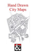
Hand Drawn City MapsClick to magnify
Quick Preview
/gs_flipbook/flip.php?xml=/demo_xml/186889.xml&w=500&h=353
Full‑size Preview
https://watermark.dmsguild.com/pdf_previews/186889-sample.pdf

Hand Drawn City Maps

ADD TO WISHLIST >

Included in this PDF (more options available than just a PDF. as of 2.7.2018, see below) are currently 7 handdrawn maps made by myself. The maps are drawn on high quality paper and have been scanned and checked carefully to ensure that they are of as good a quality as possible. Please let me know what you think about them, as that will allow me to make improvements in my techniques etc.

The cities are drawn for my own homebrew continent of Zanitar however the cities do not have name tags or something similar and can easily be used in any game setting.

A quick rundown of what you can expect:

  1. Mirandil, a dwarven settlement in the northern regions of the world, not very big but rather wealthy as they have precious metals in the mountain. There's also a large cavern in the mines that the dwarves have blocked of to stop enemies to enter their city
  2. Maedhras, a trading/military city on the banks of a small bay in the central of Zanitar, complete with protected citadel and small fishing village on the outside.
  3. Hargrave, a Large trading city centred in the same bay as Maedhras on the opposite side, noble quarters to the north and temple distric in the south, also small "drowned" slums to the east close to the harbour.
  4. Neverwinter, my take on a traditional Forgotten Realms setting, hopefully it resembles your personal view on the city.
  5. Mistpeak Hall, a human city build in the remains of an old mine in true dwarven style, protected lower levels that have arcane shops, worker quarters and so on. On the lower levels there's potential to create mines lower than the 3rd level, a very protected human settlement.
  6. A human trading settlement that has quite a few dwarves living in it, they manage the crafting guilds in the city, manning the workshops and so on. The city is plagued by orc raids that originate from further along the mountain, one of the reasons the city has a rather defendable design. However, there are those that can’t afford the protection of the walls and rely on the guards protecting them outside of the wall.
  7. Whilst primarily a trading town for the northern dwarven settlements, the main population in the town is human with elves being a close second. The city is often frequented by traveling dwarven merchants and the quality of craftsmanship is high. The city is however, highly divided and it is heavily regulated which part of the river that you are allowed to visit, live in and so on, starting at the top and going clockwise: Poor – Middle Class (Castle) – Nobles/government.

Of course these are just my views on what these cities represent and you are free to implement them in any way that you want.

Thank you for taking time to inspect my work!

1st Update! (3.7.2016)

I have added a page into the pdf - document that contains a quick rundown of all the different cities with some population estimations, size etc. Also some extra Context. Which provides some nice background information about the city. :)

2nd Update! (5.8.2016)

Added an Eisenheim map and updated the description to include information about the city. Cleaned up some small spelling errors and phrasing issues in this text and the document, such that I found.

Also once again, I hope you enjoy my work, please leave a review and feedback so I know what you think of my product. :)

 3rd Update! (8.6.2017)

At long last, there is another update, I have updated the language in the overview part of the PDF and I have also added one more map, of the norther city Addersfield, build in a tri-river-intersection. A highly divided city, for defnesive reasons but also for class reasons (read more in the overview)

Thank you once again for your continued support and I hope that you find that this new map matches with the previous quality! As ever, please let me know what you thought of my item in the comments below, thank you very much.

4th Update! (2.7.2018)

I looked through this an thought, maybe someone would like to be able to download only one of the maps, or perhaps you would like to have the options of just downloading the maps, without the summary document. In any case, I made all of those choices available. There is now the potential to download the pdf which contains all the maps and the summary document (as usual), but now, the different city maps are included as bitmaps, so you can download them individually, further, the summary document is included as a stand alone pdf and finally there's a zip file with Everything, if you don't feel like downloading separately.

I hope you're going to enjoy this update to it, and as always, thank you very much for the interest in this product.

5th Update! (14.7.2018)

I have released another product with five new maps in it, they can be found at the following address: "Hand-Drawn-City-Maps-II" I hope you will enjoy them as much as you've enjoyed these maps.

Other Products
Hand Drawn City Maps
Hand Drawn City Maps - II

pixel_trans.gif
 
 More from this Title's Contributors
pixel_trans.gif
 
 Customers Who Bought this Title also Purchased
pixel_trans.gif
pixel_trans.gif
Reviews (3)
Discussions (2)
Customer avatar
Tim B July 21, 2017 7:02 pm UTC
PURCHASER
Are these maps usable in DMs Guild releases with proper attribution?
Reply
Customer avatar
Melvalan U July 21, 2017 7:40 pm UTC
CREATOR
I just spent some time reading through the Community Content agreement and in section 2c it reads:

"“User Generated Content” shall be defined as the copyrightable elements included in your Work, such as original characters, scenes, locations and events. User Generated content shall not include the illustrations and cartographic artwork included in your work. Per the terms of this Agreement, you expressly agree that your User Generated Content, once submitted to the Program will become Program IP and useable by other members of the Program as well as the Owner as described in this Agreement."

Which to me means that any illustrations, artworks etc. are usable as is in DMs Guild releases, even if you attribute them (Feel free to correct me if I've misunderstood, and in such a case you are naturally free to use the maps). However, any and all of the content which is in written form, the cities names, sizes and so on would be attributable and releasable.

This does...See more
Reply
Customer avatar
Tim B July 21, 2017 8:57 pm UTC
PURCHASER
Makes sense! I am working on an 'urbancrawl' sourcebook for the DMs Guild, but it probably won't be released until early next year. So I'm just gathering up links and resources at the moment in preparation, and since I purchased your maps, I was curious if you'd be okay with them making their way into the product. If I were to use them, it'd only be the maps as illustrative examples, not any of the other info (i.e. text and fluff details).
Reply
Customer avatar
Melvalan U July 22, 2017 12:03 am UTC
CREATOR
Yeah, that sounds very good. As long as you credit the maps to me, you may use them in your sourcebook.

If you want something more formal than this reply giving permission, let me know. :)

Good luck!
Reply
Customer avatar
Tim B July 22, 2017 4:30 pm UTC
PURCHASER
Thanks! I'll let you know if I work them in!
Customer avatar
Andrew P July 03, 2016 6:18 pm UTC
PURCHASER
As constructive criticism (I encourage you to continue these projects) I would request some kind of scale somewhere on future maps. A simple pdf page included that would give the "quick rundown" you give above along with rough population size, would also be welcome (for human towns and cities a density of 100-200 people per hectare is usual).
For example, I had to reverse-engineer the size of Maedhras to about 25-30 hectares and 4000-6000 people.
Reply
Customer avatar
Melvalan U July 03, 2016 7:27 pm UTC
CREATOR
Hi, I'm happy that you liked my work. :)

I will look into including a pdf page with the information that you requested. Please check back after a few days and I should have had time to do it.

A scale would not be a bad idea, will try and remember that for my next project.
Reply
Customer avatar
Melvalan U July 03, 2016 8:50 pm UTC
CREATOR
Turns out I had some extra free time, there's now an info sheet inserted in the pdf that contains some contextual information and populations estimates etc. Hope it's to your liking! :)
Browse Categories
$ to $
 Follow Your Favorites!
NotificationsSign in to get custom notifications of new products!
 Recent History


Product Information
Electrum seller
Community Content
Author(s)
Artist(s)
Rules Edition(s)
Pages
8
Format
Original electronic Click for more information
Scanned image
These products were created by scanning an original printed edition. Most older books are in scanned image format because original digital layout files never existed or were no longer available from the publisher.

For PDF download editions, each page has been run through Optical Character Recognition (OCR) software to attempt to decipher the printed text. The result of this OCR process is placed invisibly behind the picture of each scanned page, to allow for text searching. However, any text in a given book set on a graphical background or in handwritten fonts would most likely not be picked up by the OCR software, and is therefore not searchable. Also, a few larger books may be resampled to fit into the system, and may not have this searchable text background.

For printed books, we have performed high-resolution scans of an original hardcopy of the book. We essentially digitally re-master the book. Unfortunately, the resulting quality of these books is not as high. It's the problem of making a copy of a copy. The text is fine for reading, but illustration work starts to run dark, pixellating and/or losing shades of grey. Moiré patterns may develop in photos. We mark clearly which print titles come from scanned image books so that you can make an informed purchase decision about the quality of what you will receive.
pixel_trans.gif
Original electronic format
These ebooks were created from the original electronic layout files, and therefore are fully text searchable. Also, their file size tends to be smaller than scanned image books. Most newer books are in the original electronic format. Both download and print editions of such books should be high quality.
File Last Updated:
July 02, 2018
This title was added to our catalog on July 02, 2016.